Snapshot of Maui

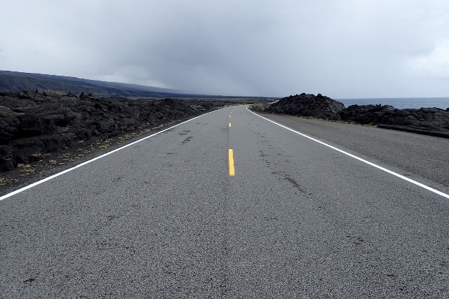
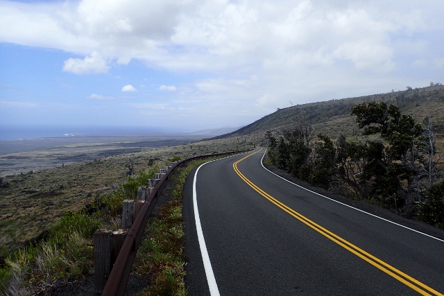
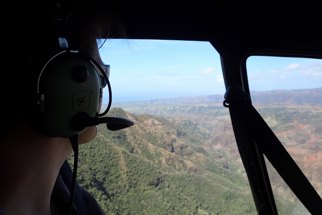
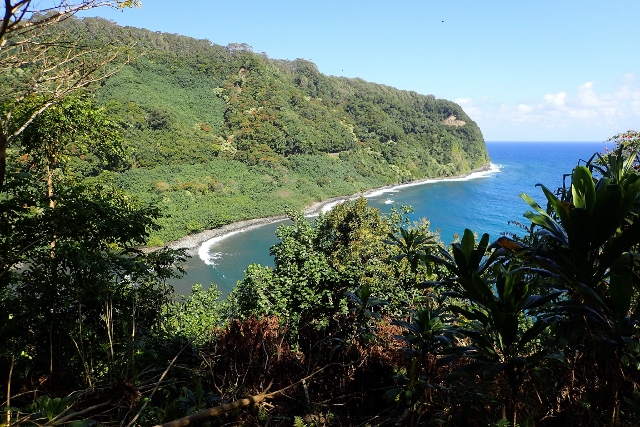
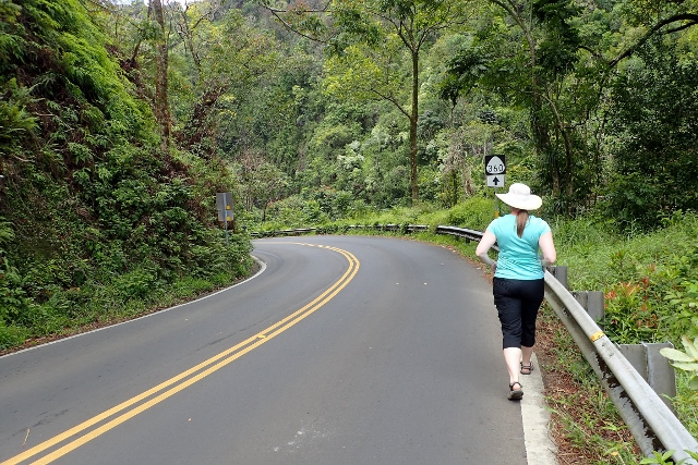
The road to Hana is without doubt, the most well-known and desired drive in all the Hawaiian Islands. It has a reputation as one of the most scenic drives on Earth and has been compared to driving through the Garden of Eden; a slow, winding road through a lush paradise that you always dreamt existed somewhere. As with any scenic drive, the point wasn’t to get to the end; fulfilment was achieved in being present for the journey, not arriving at the destination.

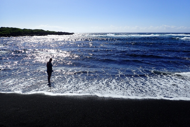
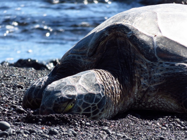
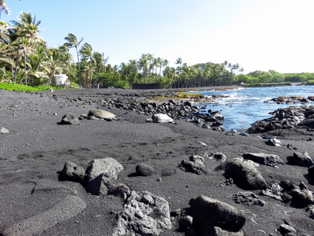
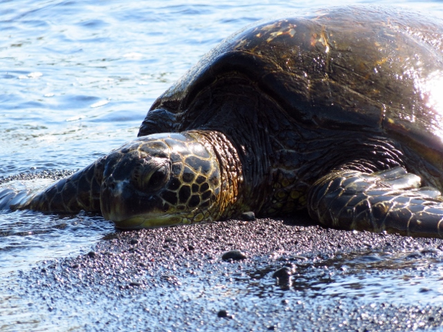
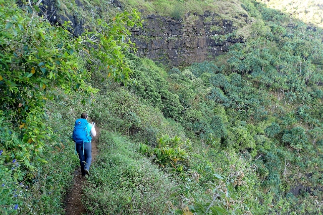
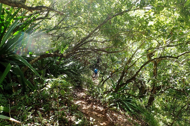
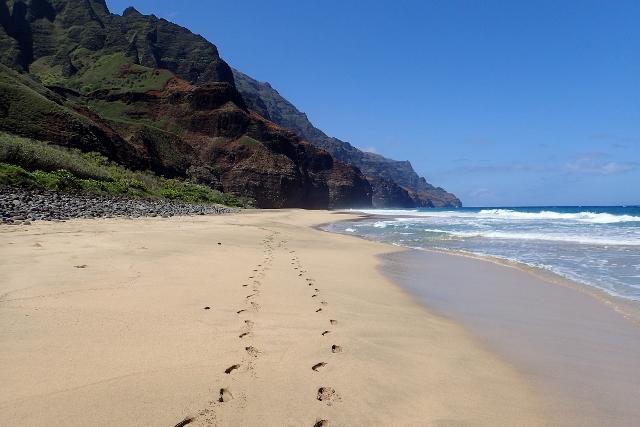
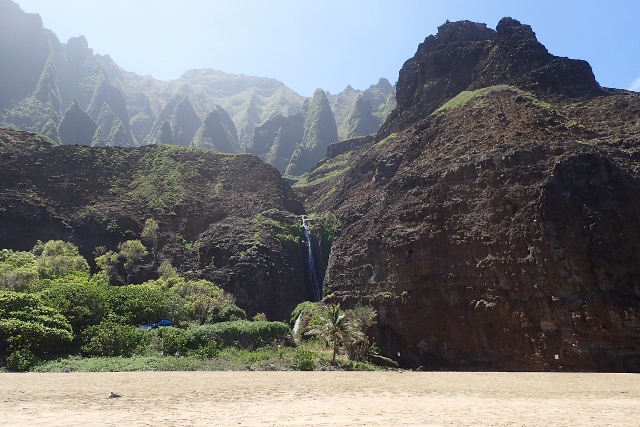
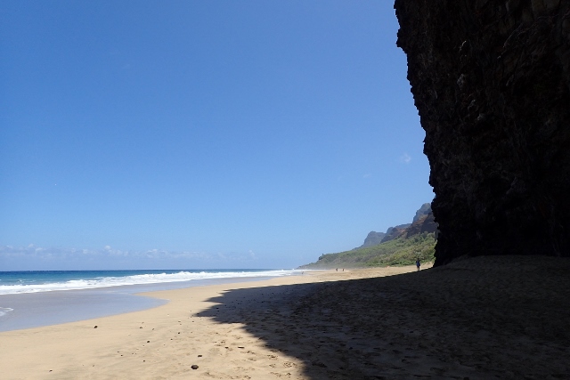
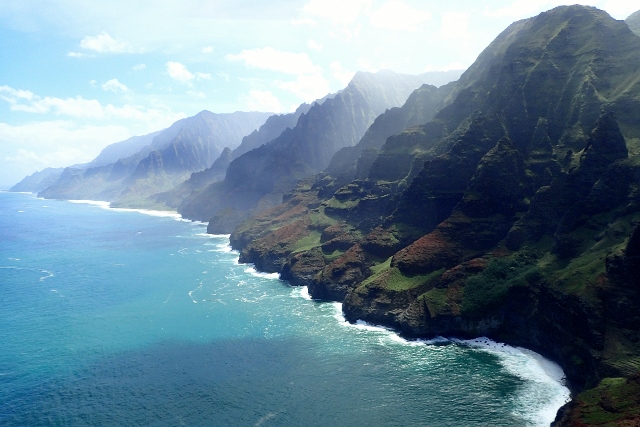
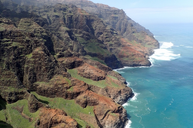
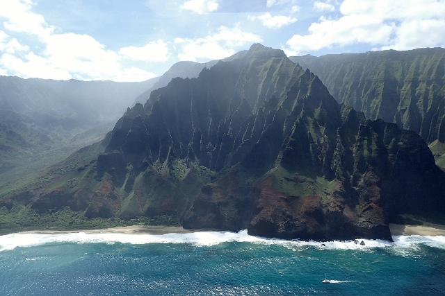
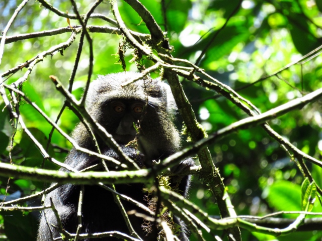
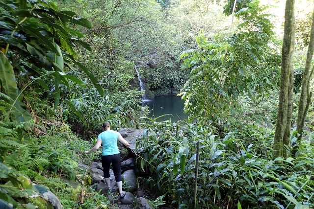
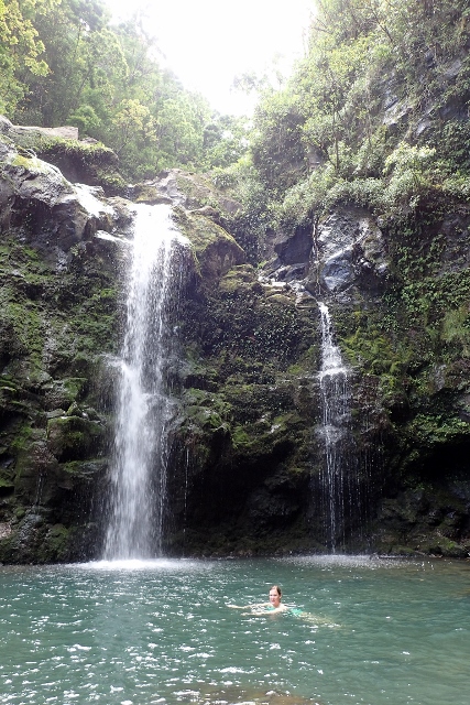
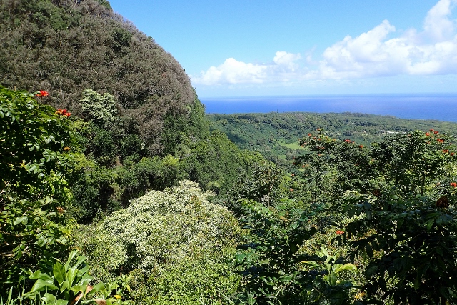
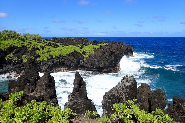
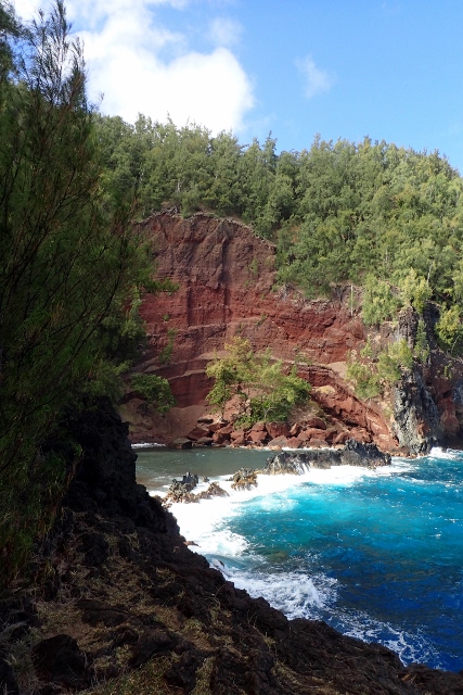
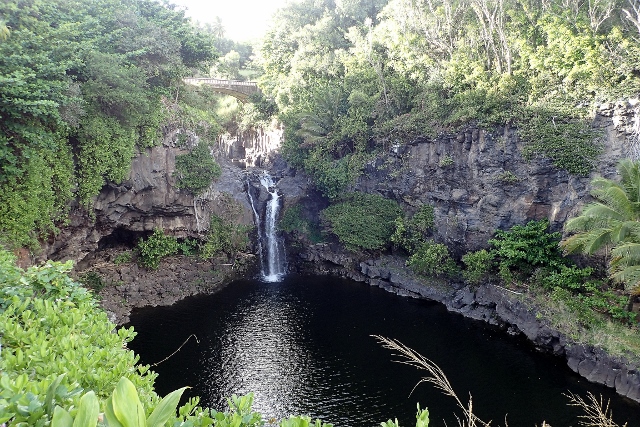
There was lot to see and do along the way besides appreciating the views from our car: the waterfalls were refreshing and their pools provided a great place to swim, as an added bonus they were often less than a two minute walk from the road, Jill and I were wowed by the black sand beach and the red (!) sand beach, and of course, we stopped at countless pull outs on the road for scenic viewpoints of the coast and forest.

It was a long drive; over 600 turns in the road (our steering wheel was almost never straight), 54 one lane bridges and a necessarily low speed limit meant that it would have taken an hour and 45 minutes even if we didn’t stop anywhere. We started the drive at 8 and didn’t finish until after sunset.

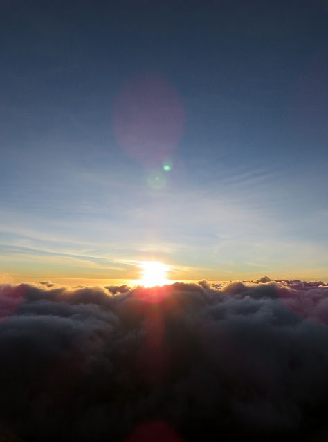
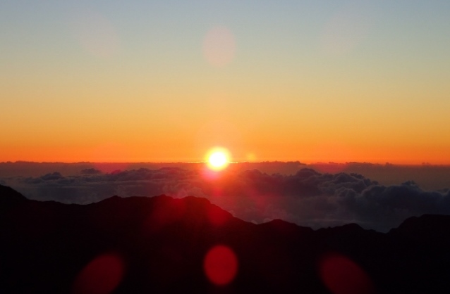
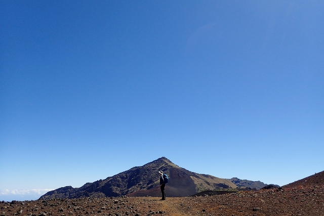
Sunrise at the top of Haleakala, Maui’s highest point (3,055m (10,023ft)).

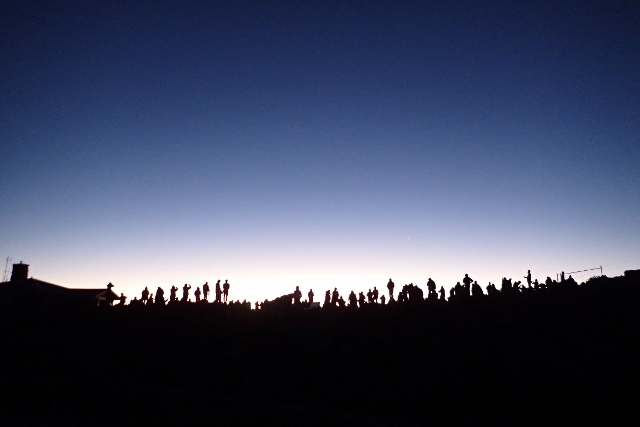
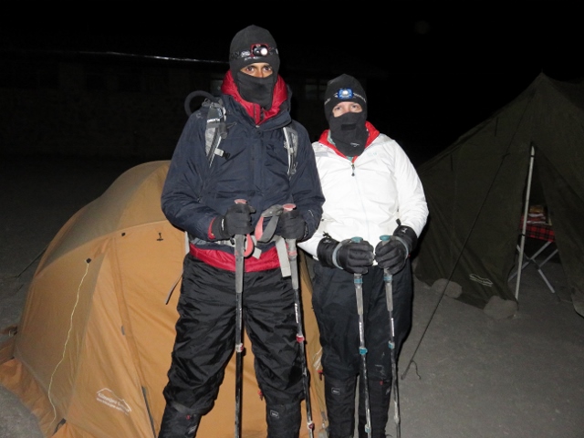
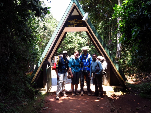
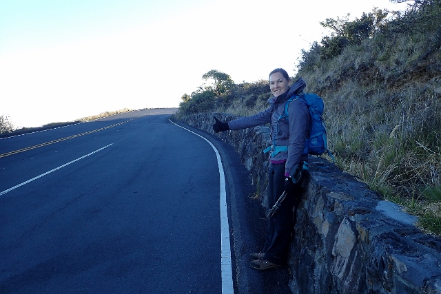
Jill and I planned to start a 12 mile hike on Haleakala after sunrise but first, we needed to move our car to a lower parking area. The hike we were about to do was not a loop so we needed to either hitchhike back to our car at the end, or drive our car down to the finishing point and hitchhike up to the start of the trail. It was apparently easier to get a ride in the morning so we drove down, parked our car and walked to the nearest pull out to try our luck.

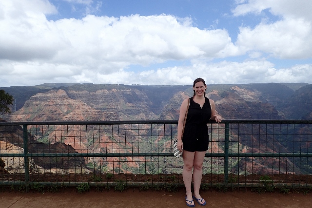
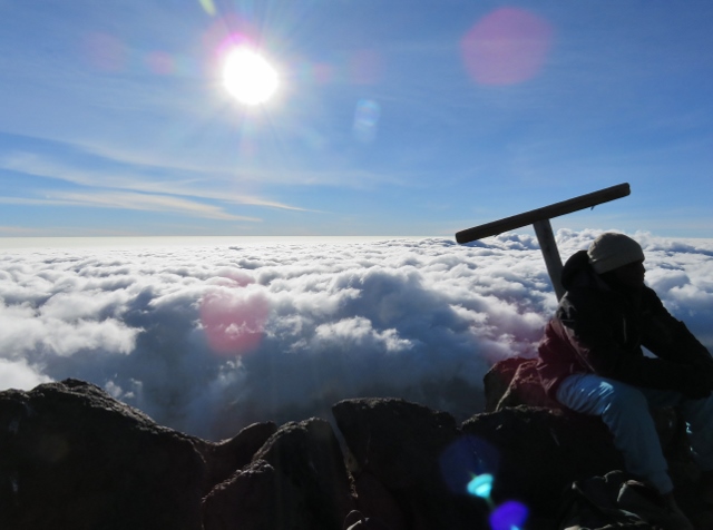
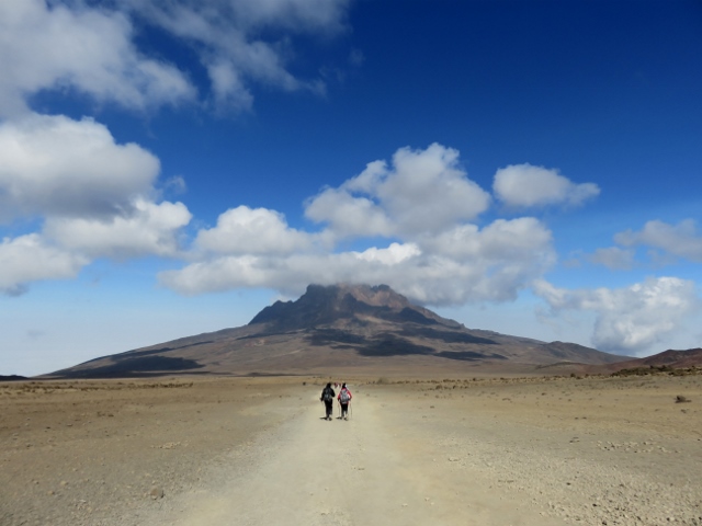
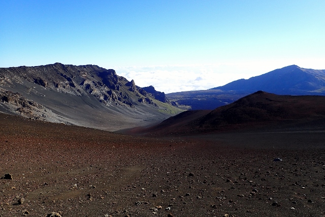
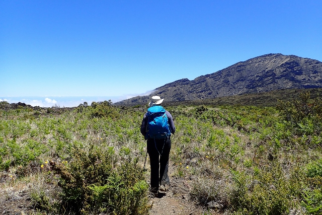
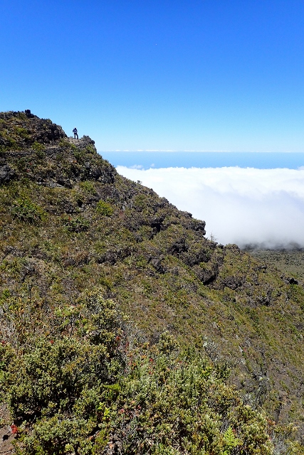
Haleakala was quite simply, stunning. I was blown away by its beauty and incredible variation. My hike here was one of the best that I’ve ever done.

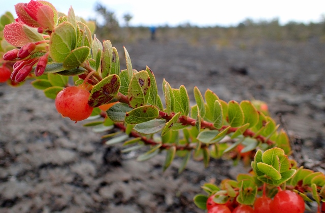
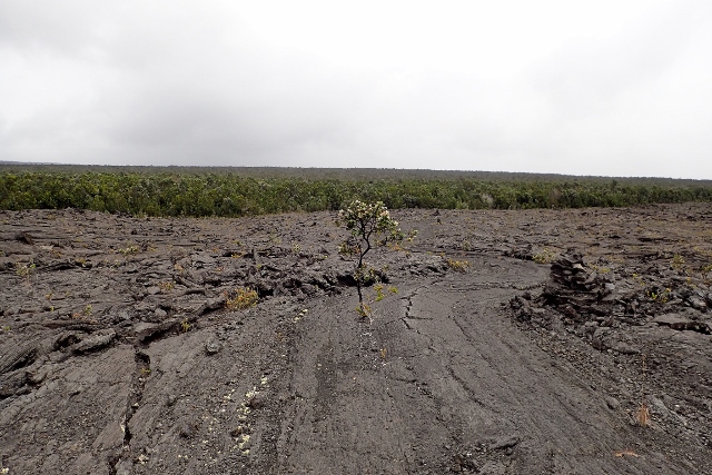
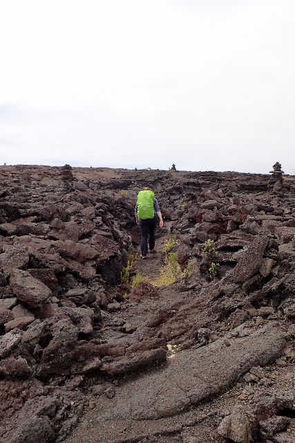
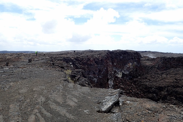
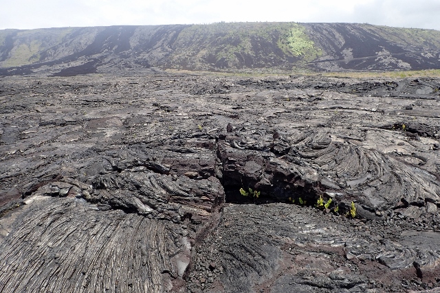
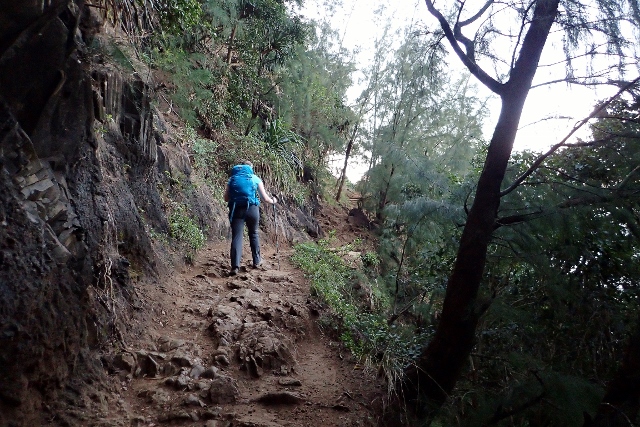
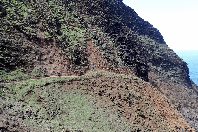
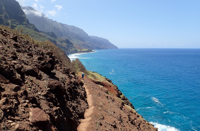
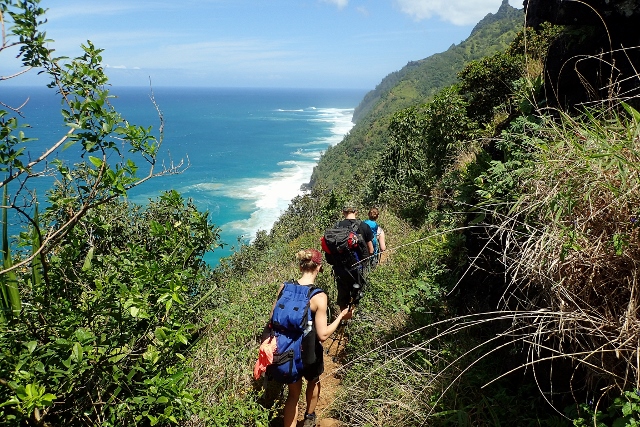
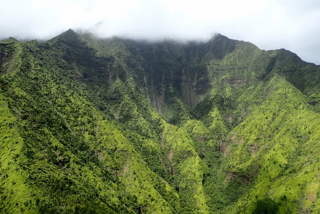
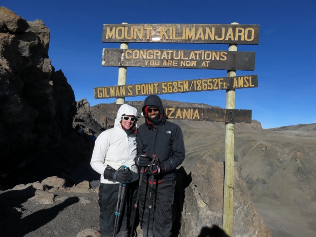
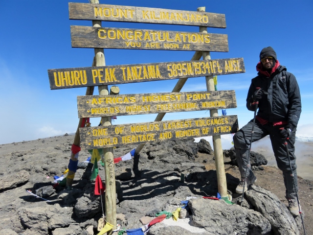
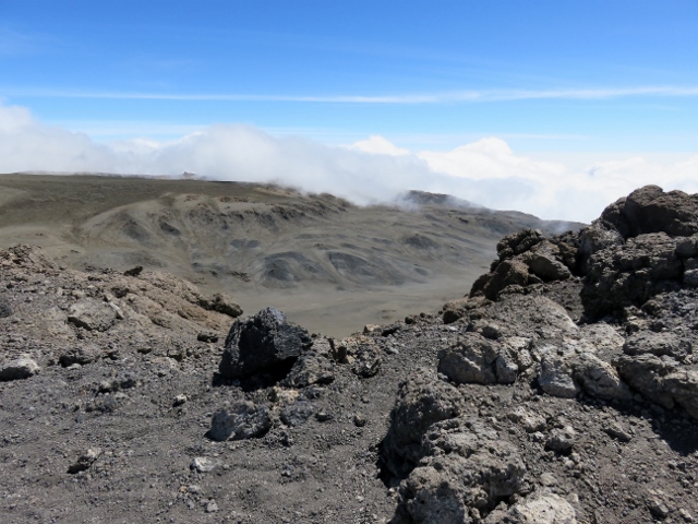
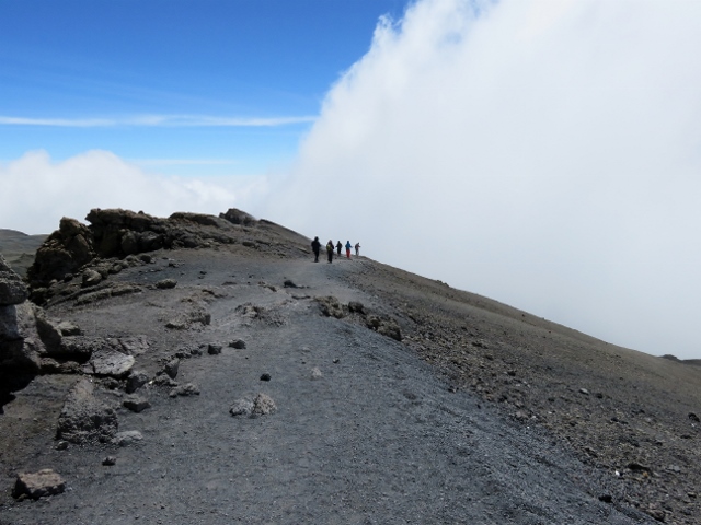
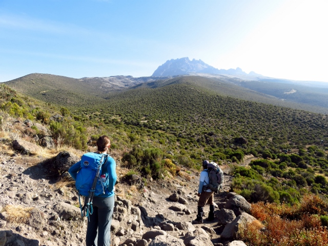
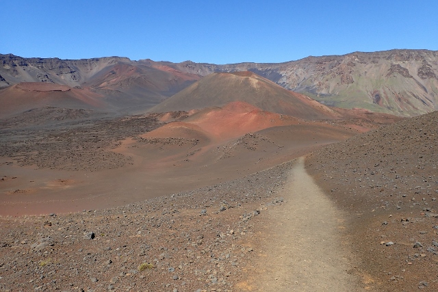
It started slowly. Over the course of several loose switchbacks, the path gently wound its way around the volcano, eventually leading us to the rim of the caldera. The view was reminiscent of both Kilimanjaro and central Mongolia; most of the volcanic rock was a dark shade of grey but there were also browns and reds, later when iron became more prevalent in the rocks and boulders, red became a much more frequently observed shade in the environment, desert shrubs were sparsely dotted about the landscape and the downhill slopes of some of the mountains distinguished themselves with flourishes of a faint green. And yes, you read that correctly, I said mountains. Just like on Kilimanjaro, multiple peaks could be seen; it was as though there were several mountains on the mountain, but really, it was just one massive caldera.

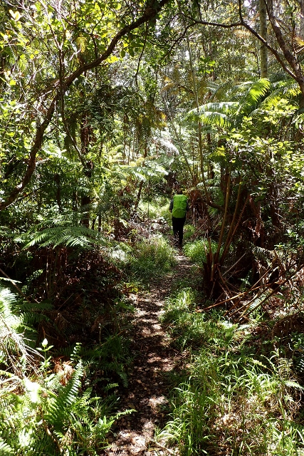
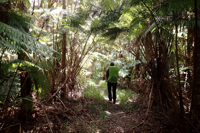
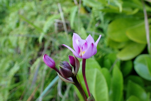
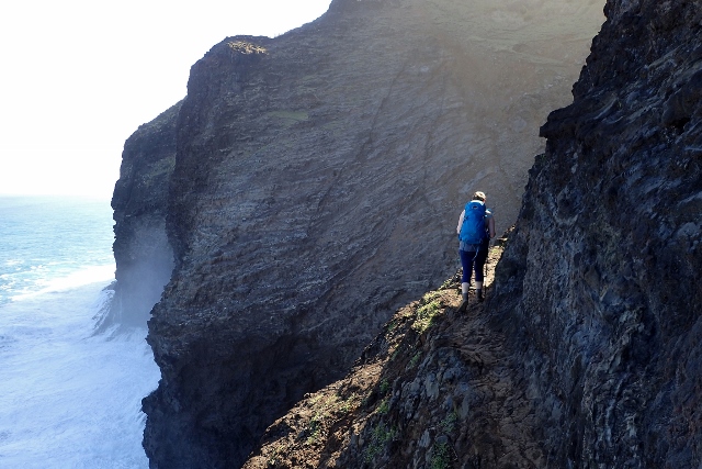
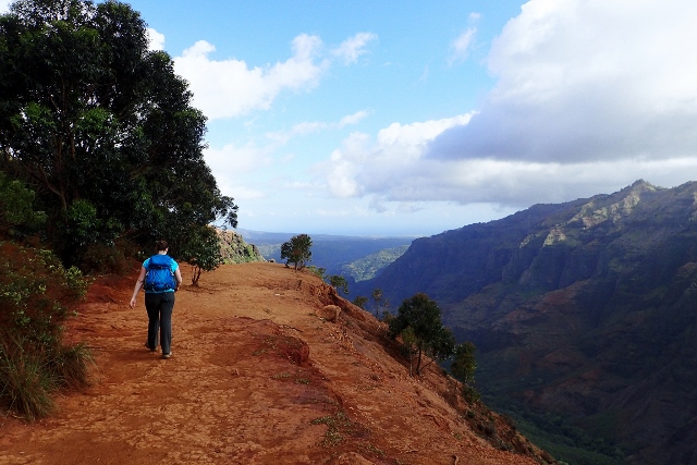
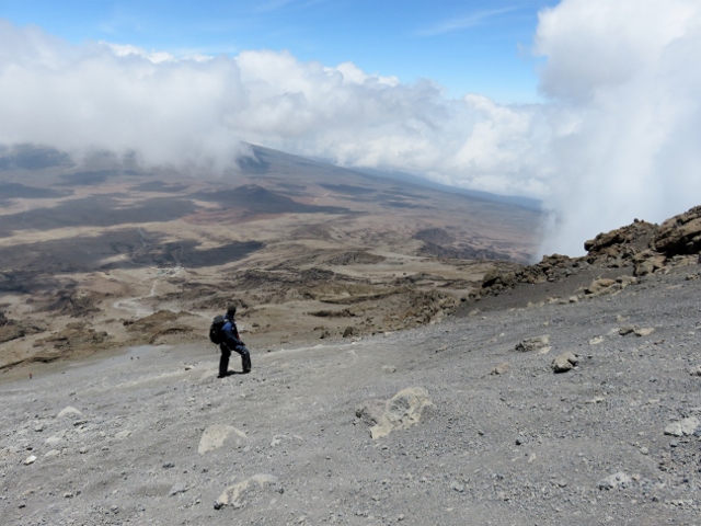
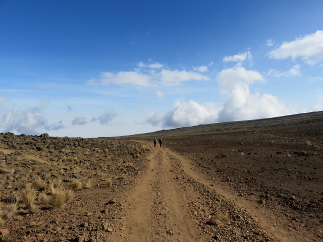
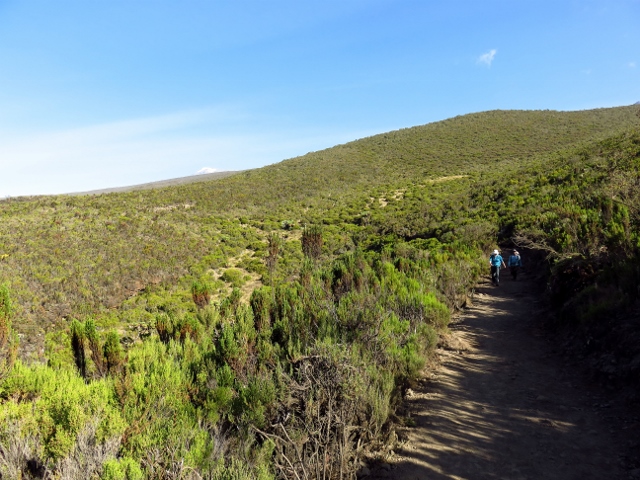
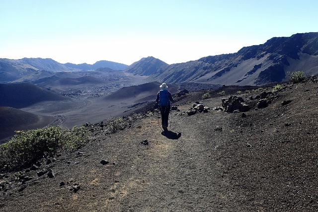
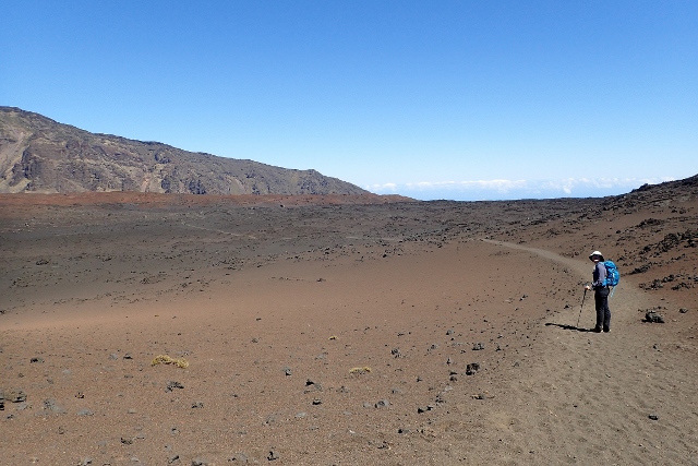
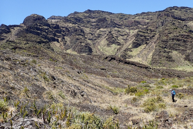
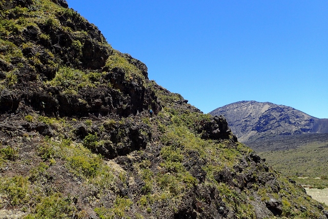
The trail led us up, down, over and around the mountains, with hugely diverse scenery along the way. We hiked up hills that had layer upon layer of weathered volcanic rock underfoot. The rocks must have been there for tens of thousands of years because they’d been weathered to the point that they were indistinguishable from black sand. It was like we were walking up a sand dune. Further down, on the other side, mountains that fashioned distinct hues of red and green could be seen off in the distance along with craggy cliff faces, just like in Mongolia, but all still within the microcosm of the caldera. The trail cut through an old lava field with large volcanic rocks on either side of the path. There were huge variations in the topography of the rock; at several points, it was as though I was looking at a miniature canyon, complete with its own peaks and valleys. Desert shrubs could be seen all over the lava field, adding to the effect. Later in the hike, there was an explosion of large, vivid green plants. Next to the dark grey of the rock, they were practically incandescent. The path continued, transitioning completely to become a grassy field. The shift was accompanied by a wide range of plants and vegetation that I hadn’t seen so far in the area. It was wild how different the environment had become in the course of a few hours.

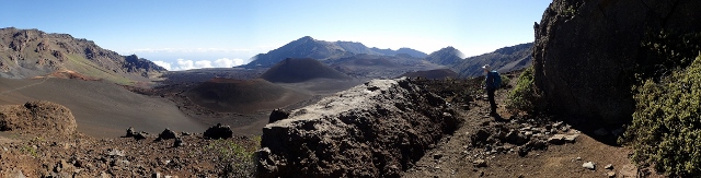
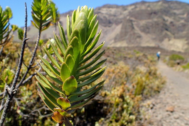
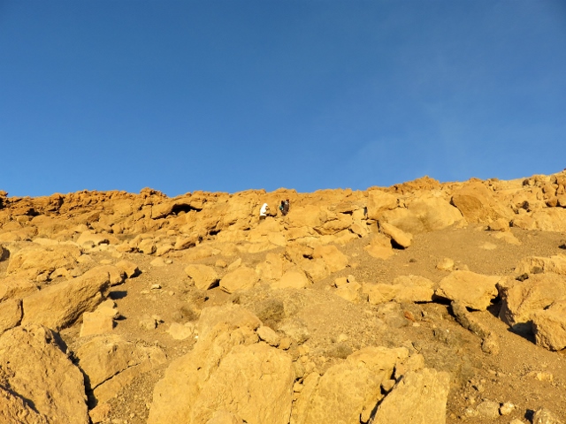
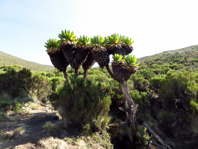
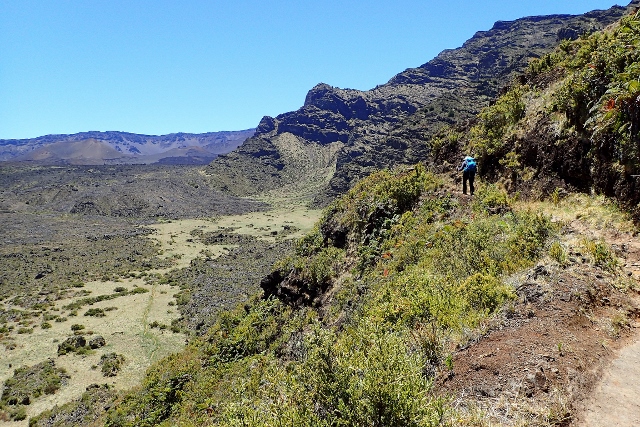
The 1,400 foot hike up the crater was ridiculously picturesque. It was tight switchback after switchback all the way but the edge of each turn was completely exposed and free of vegetation meaning that you had a stunning view and a killer photo opportunity (of both the crater and the hiker standing up there), literally around every corner. Just like I’d seen earlier, the contrast between dark grey volcanic rock and bright green plant life, provided a startling juxtaposition. The vegetation was more varied now than it had been at any other point on the hike. A nature photographer would have blown their load as soon as they first caught a glimpse of this place. There was a new marvel of nature to see literally every couple of minutes. When you got bored of looking at one stunning landscape, a switchback would lead you in the other direction, giving you a completely different stunning landscape to look at. When you were back facing your original direction, the higher elevation meant that what you saw a few minutes earlier now looked different enough to capture your interest all over again. I absolutely loved every second of it.

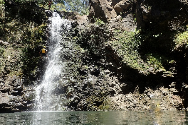
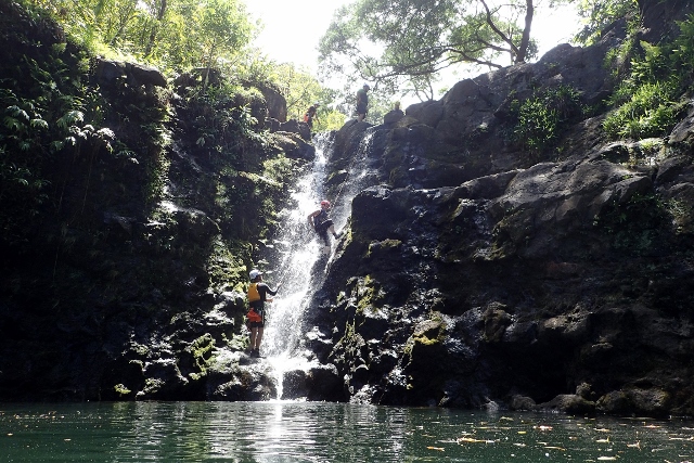
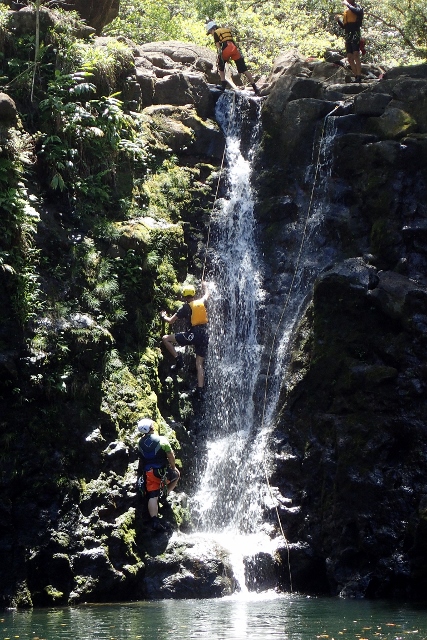
Jill and I loved waterfall abseiling (rappelling) when we tried it a few years ago in New Hampshire, and welcomed the opportunity to try it again. This time, we abseiled down two waterfalls, rock climbed back up one of them and to finish, zip-lined down into a pool below.

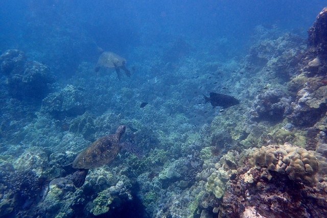
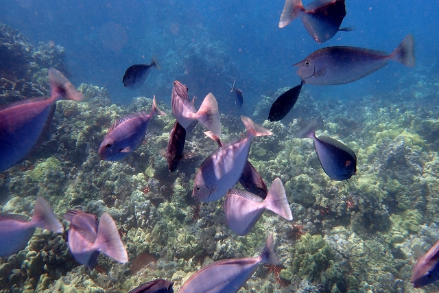
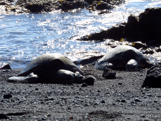
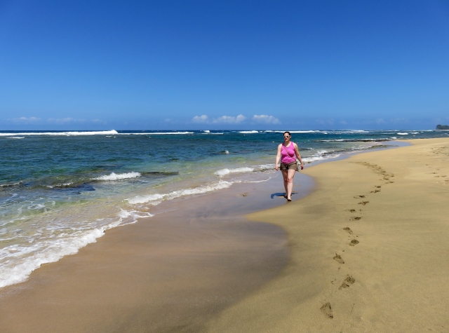
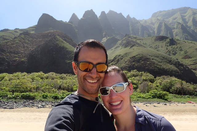
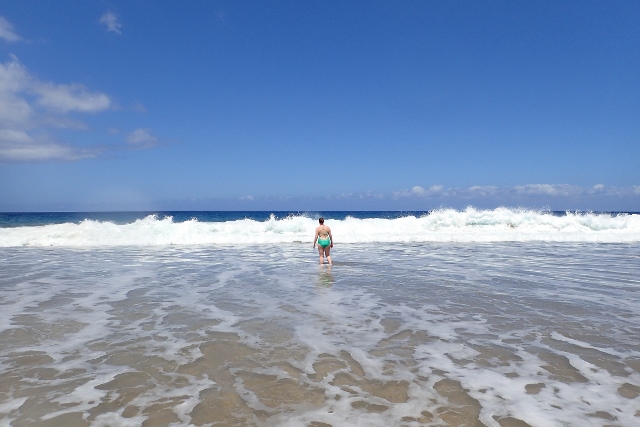
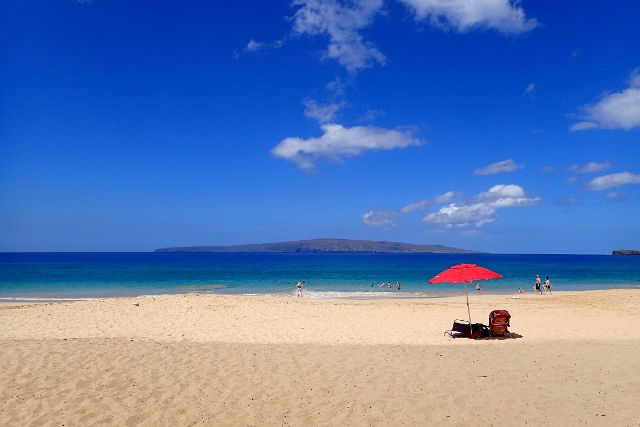
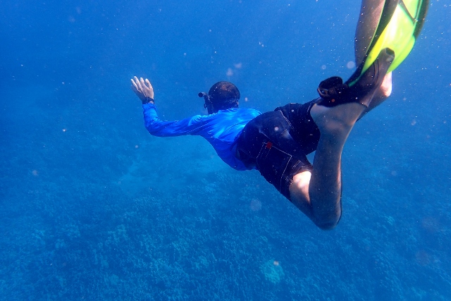
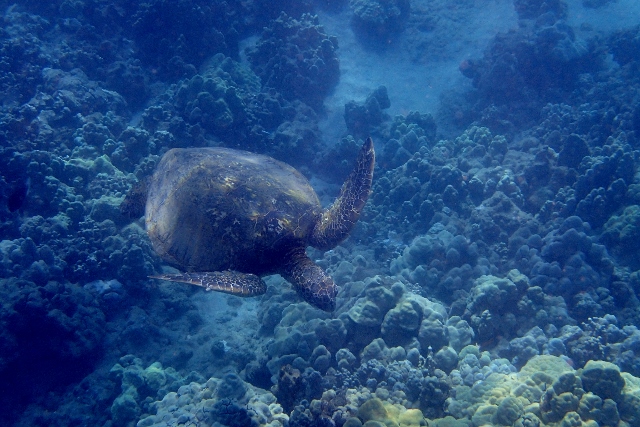
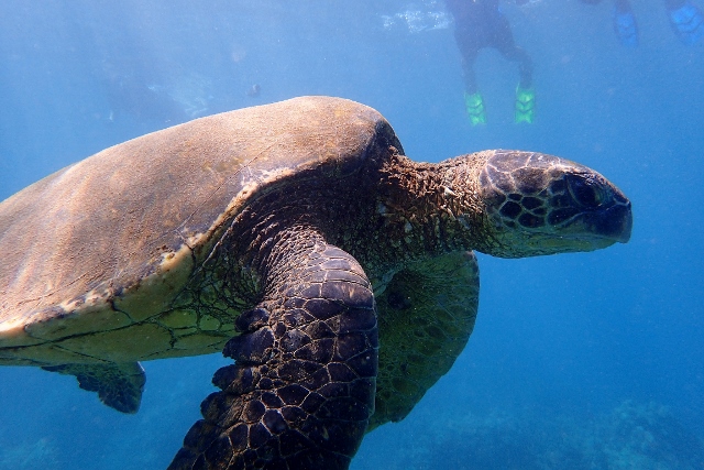
Jill and I spent our last full day in Hawaii relaxing on beaches and snorkelling.

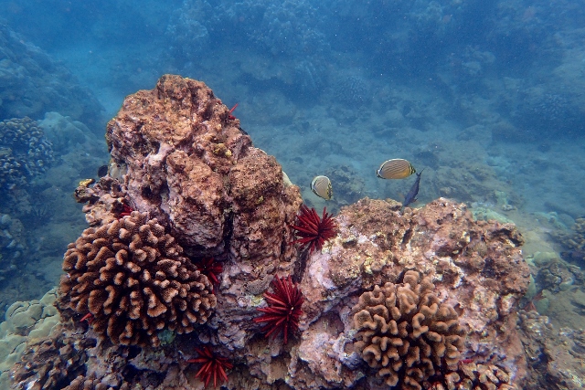
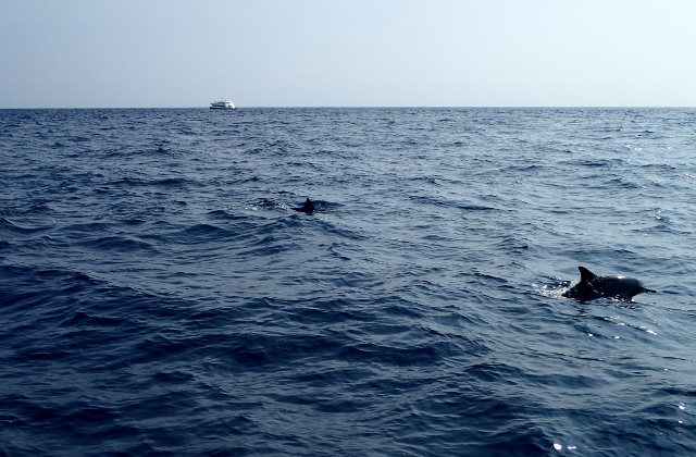
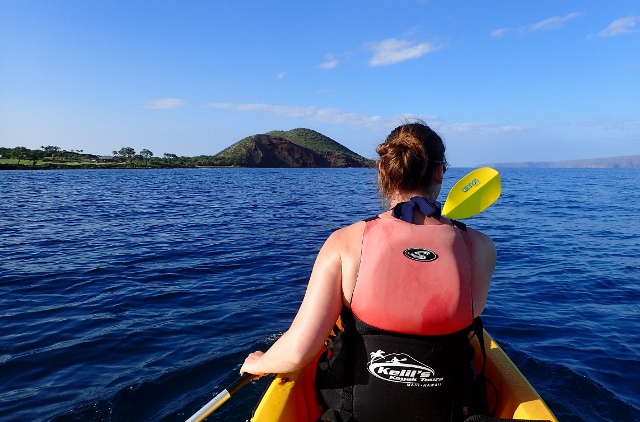
Our flight back to Boston didn’t leave until 22:10, leaving us the whole day to go kayaking and snorkelling. Jill’s motion sickness didn’t do her any favours when our kayaks were anchored at sea but apart from that, it was a great time.

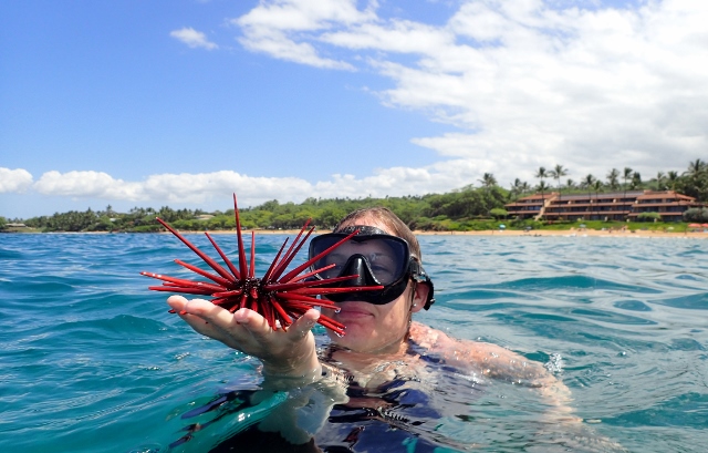
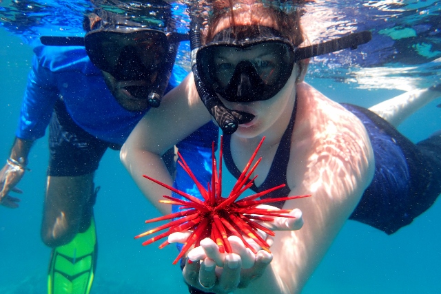
At one point, our guide dived down without warning. When he came back up, he put this sea urchin on Jill’s hand before she had a chance to say that she didn’t want anything to do with it! Feeling it move was the strangest thing; it was almost like a really low powered hand massager.

Snapshot of Hawaii (Big Island)

Hawaii, which I’ll refer to as Big Island to avoid confusion, is the youngest of the Hawaiian Islands and the only one that is volcanically active. Kilauea, though small compared to the other volcanoes, is the most active of the five that together form Big Island. It put on quite the show for us while we were there. The lava was so turbulent, it sloshed around, bubbled, splashed, if it wasn’t for the bright orange colour, I’d say it was behaving more like water than lava. It was so cool. I was mesmerised.

The Napau Crater Trail was a two day hike. The volcanic desert that lay before us was a vast expanse, rich with striking rock formations. The shapes, features and contours of the landscape varied dramatically; whorls, spirals, obelisks, too many forms to count, or name. Sparsely dotted desert shrubs added flourishes of colour (red, green, white), to the grey-brown tones of the surrounding area. In shaping the outward appearance of this environment, from formless magma deep within the Earth to the sharply defined structures that I could see in front of me, nature drew on a pool of infinite possibility. Here, on this ancient lava field, the realisation of nature’s geological processes seemed no less varied than the boundless potential that seeded them.

When Jill and I got our camping permit in the morning, the park ranger told us that we’d be the only ones out there. There wouldn’t be anyone else around for miles and miles. It was a little unnerving knowing this, especially when it rained at night, when we wouldn’t have been able to hear someone approaching our tent. Jill kept saying that we were going to get murdered by crazy people living out in the forest and repeatedly insisted that I sleep with my camping knife within arm’s reach.

Apart from a little mouse (possibly a rat), that kept trying to climb up onto our tent, we didn’t have any trouble. Jill was quite vigorous each time she shook him off though.

Chain of Craters Road was an absolutely stunning drive, reminiscent of both New Zealand and Mongolia (my two favourite countries outside the U.K.); verdant mountains, volcanic lava fields, unique vegetation and expansive views of the Pacific Ocean. Such a vast range of environments being represented while driving down a single, relatively short road was a rare gift. We stopped by the side of the road at several points to fully absorb the immense beauty of our surroundings.

Thurston Lava Tube.

Jill and I cycled 8 miles to Big Island’s “Lava Viewing Point”. This was where Kilauea’s hot, flowing lava could be seen entering the cold, unforgiving ocean. The lava was only about half a mile away but it was largely obscured from view by the immense plumes of smoke it generated upon contact with the water. The appearance of those billowing clouds rising from the ocean changed dramatically as daylight faded. We caught glimpses of the lava itself, much more frequently. We even saw chunks of smouldering rock (freshly cooled lava), being thrown from the smoke into the sea. The rocks sizzled like a frying pan does when you throw water on it. After sunset, the now orange smoke was hypnotic. Every now and then, the lava would flare up, piercing the clouds of smoke to dramatic effect as the calm dance of reds and oranges became momentarily violent.

Big Island’s black sand beach (Punalu’u Beach), is known for the hawksbill turtles that frequently visit. Before we’d even started to look for them, we saw five just chilling on the beach. There were many more in the water. Jill and I hadn’t planned to snorkel here but the fact that we had our masks and snorkels in the car meant that we could if we wanted to. We realised quickly that we didn’t want to miss this.

The turtles in the water were massive and didn’t seem to mind us being there at all. They swam right by me several times. Apart from the turtles and the fish, Jill and I were the only ones there.

A curious pod of dolphins swam alongside our small boat when Jill and I were on our way to a scuba dive.

The tiny 8-seat aircraft that took us from Big Island to Maui was so small that the co-pilot doubled as cabin crew and gave us the safety briefing. I could see the cockpit during the entire flight and our seat belts went over the shoulder, just like in a car. The views during that short, 45 minute flight were amazing.

Snapshot of Kauai

Even before we left for East Africa last year, Jill and I knew where we’d be going on holiday next. I didn’t realise it at the time but the decision was sealed as soon as I found out that my lovely wife hadn’t seen Disney’s Lilo and Stitch. I thought the film was good and knew that Jill would absolutely love it, but couldn’t have guessed that she’d still be listening to the songs two years later, or that we’d end up flying over 5,000 miles from home, all because of that infectious Disney magic.

Unconventional selection process aside, Hawaii was supposed to be different…

After we’d decided on a destination, Jill and I thought it would be a nice change of pace to have a relaxing holiday where we laze in the sun, go to restaurants in the evening, and not much else. It was a nice idea while it lasted… Within a month of having decided what we’d be doing, the plan had slowly morphed from sun and relaxation to hiking, kayaking and scuba diving. As far as the ratio of activity days to relaxation days goes, this holiday went from by far our most lazy, to our most active! We’d be hiking for 10 out of 15 days, and kayaking or scuba diving for the rest.

This was one of the first beaches that we saw on Kauai. It looked great but the island got so much better.

On our second day, Jill and I began a three day hike on Kauai’s famous Na Pali coast. The region’s Kalalau Trail is frequently cited as one of the world’s best hikes, something that Jill and I both knew going in. I’d perched this hike atop a mountain of expectation that it couldn’t possibly have lived up to, but it did, and then kept soaring. Over the course of 12 miles, the undulating path alternated between inland forested areas, and exposed jaunts on the coastal cliffs, offering up stunning views whichever way we happened to look. It was without question, one of the best hikes that I’ve ever done.

This was where almost 9 hours of hiking got us; Kalalau Beach. Since it’s at the end of a 12 mile trail, and is only accessible by foot (or from the water), very few will ever see its untouched beauty. (Kauai is the oldest of the Hawaiian Islands and it’s not going to be around forever). Jill and I camped here for 2 nights. When I arrived, I wasn’t looking forward to the walk back but after a full day here, I was so relaxed that I could barely remember it.

While we were at Kalalau Beach, this waterfall was our shower.

The hike back was fraught with danger. I later learned that this trail is ranked one of the ten most dangerous in the world. Based on my experience, it would seem for good reason.

The day after getting back from our hike, Jill and I took a helicopter flight over Kauai and witnessed unspeakable wonder. I’d already seen and marvelled at the Na Pali coast’s stunning formations during my three day hike there but I was blown away by how much more beautiful it looked from the air. It was already one of the most incredible things I’d ever seen, I didn’t think it was possible for it look any better. The verdant mountains and volcanic rock cliffs rose to majestic heights and the powerful coastal waves were clearly visible even from several thousand feet up. The water looked incredible, such vivid shades of blue. We flew inland, over Kalalau valley and navigated between the grass and vegetation covered mountains. There were dozens of wispy waterfalls, some over a thousand feet long. Our pilot weaved the helicopter through the valley highlighting its unique natural formations as we went. This for me, was the single most impressive part of the flight. It was beyond description. I was looking at it with my own eyes but still couldn’t believe that it was real. It was magnificent. Probably one of the only times in my life that my breath has literally been taken away. Picture the most stunning aerial shots from Jurassic Park and you’d have the language but not the poetry. After enough time has passed, and I’ve had a chance to process what I saw here, I have a feeling that I might come to think of it as the site of Earth’s greatest beauty.

Kalalau Beach, as seen from the air.

Waimea Canyon Lookout.

These pictures were taken on the first of two hikes in Waimea Canyon.

These pictures are from our second Waimea Canyon hike.

Hiking Mount Kilimanjaro

There were many good reasons for Jill and me to come back to Africa but for Jill, this trip was all about the mountain gorillas. She really wanted to see them in their natural habitat (and if an opportunity to do so presented itself, smuggle one of the babies back home to America). Now that the trip is over I’ve got countless experiences that I can look back on, many that I’ll likely remember for the rest of my life, but before I left, the only thing I had on my mind was seeing the top of Kilimanjaro. At nearly 6,000m (20,000ft), this mountain is the highest point in Africa and the tallest freestanding mountain in the world. I knew that climbing it would present a unique challenge. I wasn’t disappointed.

a-640x480

a1-640x480

a2-640x480


Like most mountains, Kilimanjaro has multiple zones. Seen from afar, it just looks like a single peak made of rock but when you get closer you realise that it’s much more interesting than that. Agriculture, farms, forest, rainforest, large mammals (buffalo, elephants, apes), alpine desert, glaciers, all of these and more can be found on Kilimanjaro.

a3-640x480

a4-640x480

a5-640x480

OLYMPUS DIGITAL CAMERA

a7-640x480

Mawenzi, Kilimajaro’s second highest peak.

a8-640x480

a9-640x480

Each day, Jill and I carried four litres of water, our snacks and any clothes that we might need. It was a lot of weight, weight that made the climb more difficult than it otherwise would have been. We didn’t carry the food that we ate for lunch or dinner though, or our tent, or the rest of the clothes that we’d brought along for the hike. It took a small village to get us up the mountain; two guides, a cook and ten porters. To the top and back, we both went a long way but we wouldn’t have got anywhere near as far without such a great crew supporting us!

a10-640x470

a11-640x480

a12-640x480

a13-640x480


a15-640x480

Kibo Hut, the final camp before our summit attempt.

a16-640x480

We started the attempt at 23:30 in the hopes of making it to Kilimanjaro’s crater by sunrise.

a17-640x480

a18-474x640

a19-640x480

a20-640x476

Gilman’s point, the top of Kilimanjaro’s most gruelling, unforgiving climb. Despite being just a short distance from Kilimanjaro’s summit, Uhuru Peak, Jill had to turn back here. The altitude (almost 5,700m, or 19,000ft) at this point, had led to complications with Jill’s vision. She could only see colours and vague outlines of objects and people. This was dangerous not only because she could have fallen to her death by continuing, if she’d gone any higher, she may have risked permanent damage to her eyesight. Each person’s body reacts to these harsh conditions differently; humans are not meant to be up this high. The low air pressure affected Jill more than it did me but the low oxygen level definitely hit me much harder. My body felt like it was shutting down at several points, pushing through that feeling and continuing upward was an incredible struggle. Jill’s sight returned to normal the following morning, after we’d descended 2,000m (6,500ft).

a21-640x480

a22-640x480

Uhuru Peak, the top of the highest freestanding mountain in the world.

a23-640x480

a24-640x480

a25-640x480

The long, dangerous path back down.

a26-640x480

With the vast, expansive views that we were treated to during our descent, it didn’t feel like we were on a mountain, it felt like a national park in the U.S. or even, a small U.S. state. It’s difficult to express just how large Kilimanjaro is.

a27-640x480

a27a-640x480

a28-640x480

a29-640x480

a30-640x480

a31-640x480

a32-640x480

a33-640x480

a34-640x480

An elephant flower (impatiens kilimanjari), so named because of the elephant trunk-like protrusion at the bottom. This flower can only be found on Mount Kilimanjaro.

a35-640x480

a36-640x480

A blue monkey. These monkeys actually look black when they’re up close, but, when viewed from a distance, in direct sunlight, they appear navy blue because of the way that their fur refracts light.

a37-640x480

Jill and I at the end of our hike with Ignas and Francis, our two guides.

a38-640x480